Summer 2003.
What to do?
You know that over the last few years we've eagerly taken advantage of our cabin. This summer with our new boat the reasons for going to the Shuswap was even greater.
Yet we're supposed to be preparing to hike on the Chilkoot. How are we ever going to be in shape to hike the golden stairs with a big pack on our backs if we're spending 10 hours every weekend driving to and from the Shuswap?
Easy!
We hike at the Shuswap.
To take advantage of our boat, we've done several hikes this summer that involve driving the boat somewhere and then going for a hike.
The first thought that came to mind was that we should hike over the mountain from where Glen's parent's old cabin was (and the Cowles' and Nicholson's still have a cabin) to the Cassel's cabin.
Why, let's do it twice!
The first time was on Saturday, June 7th. The adventurers were Susan, Glen, Glen's Dad, and Keith Nicholson. Glen's GPS had just arrived the day before so when it came time to do the hike, it seemed like a good idea to really give the GPS a good trial for hiking under tree cover. We started off in the Magic Carpet from Anglemont a little before noon. We headed over to the Cassel's where we took a GPS reading. At about 1:00 we arrived at the Cowles' and Nicholson's. The GPS told us that the distance to go would be just over 4km. To many a hiker that doesn't sound like much, but understand that this is hiking through heavy forest, without a trail. After eating lunch and having a good visit, we headed off into the woods. The GPS had told us the exact direction that the Cassel's cabin was in. The up-down part over the hill runs predominantly North-West to South-East, but the direction between the cabins was slightly East of North, thus the direction to head was at an angle up the hill.
The hiking was heavy going. Steep, rough ground, and hot! Surprisingly about a kilometre in we came across a road that hadn't been there the last time this was done (about 10 years previously when Glen, Glen's dad, and Reg Cowles had done the hike). In order to make up some East direction, we followed the road east until we were again surprised in that it basically just seemed to end. I guess it was a logging road with no real destination. Again pushing into the trees we struggled on. We came across a quail and it's brood (not sure if that's the correct term, but it sounds right). We scrambled up hills. We were chased by mosquitoes. Again we came out on a logging road. Again we headed east. This time the road didn't end, but instead faced us with a decision when it split. After a split decision (pun not intended) we spent about 15 minutes going down what ultimately seemed was the wrong choice. Retracing our steps we took the other route.
There were numerous roads, and we picked our way carefully through a field full of thorny bushes. In the middle of the field we were approximately half way (according to the GPS). We also could see that we were starting to go down the other side of the hill. We also could use our FRS radios to talk to Glen's mom and Annette Nicholson who had gone to the Cassel's in the boat so as to be ready to pick us up. Once through the field the walking was much easier, since we found ourselves on a road that Glen's dad soon recognized as heading to the Cassel's. Three and a half hours after leaving, we finally made it to the Cassel's.
Lessons learned? 1. The GPS doesn't work that well when in heavy tree cover. 2. For this particular hike, it's better to push straight over the mountain and use the roads to make up the lateral to get to the end-point.
Three weeks later we were at it again. June 28th. To continue our Chilkoot preparation we again headed to the Cowles'. This time we picked up Dale Cassel who would be making the hike with us. Boy, did we ever feel underprepared. Dale was carrying a bear-banger, as well as an axe! Again after eating lunch and visiting, Glen, Susan, Glen's Dad, and Dale headed into the trees. This time we knew to head more straight up. On the first road, we did a bit of lateral, but pushed into the trees before we reached the end. On the second road we knew where to go on the split. This time the field was quite high growth (again with burrs), and we stopped to take a picture. Once through the field we again walked along the road. We were smarter that day, but since Glen was feeling quite tired, we weren't able to really take advantage of the better route and we again got in at around four hours.
Both great trips, and we certainly do know that mountain now!
The weekend of July 5th, we weren't able to be quite as aggressive, since we wanted to be able to include Glen's brother's Jim and his family. Taking a one year old on a hike like the one over the mountain didn't seem like a good idea.
The idea came up that we should hike to Hunakwa Lake, at the end of Anstey Arm. Jim and Ellen had been there years before. Dale Cassel also joined us.
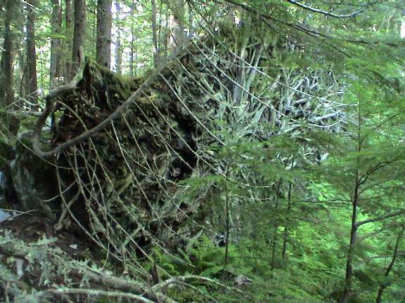
We headed off, with Jim carrying Jessica. We actually had quite a crowd. The scenery along the trail is really beautiful. We saw some really big trees. We saw some really big trees that had fallen. The creek running along side the trail, with the growth being a beautiful green. About 30 minutes of hiking and we made it to Hunakwa Lake, very nice!